Pea Patch Island (Figure 1) is a historically and ecologically significant island located In the Delaware River. The island contains Fort Delaware is a major Heronry. It is threatened by sea level rise and shoreline erosion. Scarping can be observed at the ends of the existing stone embankment. The Delaware River is a major shipping route for Philadelphia, Wilmington, Camden, and Trenton. Ships generate wave forces that otherwise are uncommon in low-energy environments. The effect of these ship-generated waves on the shoreline is unknown.
A transect consisting of 5 stations (M0-M5) was created at the study site for data collection (Figure 1). Sensors and a time-lapse camera were deployed on the island for one month to collect data to analyze ship wake characteristics and bed change.
The Senior Thesis research is underway but preliminary analysis identified two types of ship-generated oscillations: low-frequency and high-frequency. Low frequency oscillations are generated by displacement of large vessels traveling at subcritical speeds (Figure 2). They have a much longer period than high-frequency ship-generated oscillations and wind waves. The initial force from drawdown and surge is large and should have an impact on morphology. High-frequency waves are generated form the bow and stern of the ship and depend on the ship speed, dimensions and draft. Figure 3 shows high-frequency wave generated from two different vessels; one loaded (left) and the other unloaded (right).
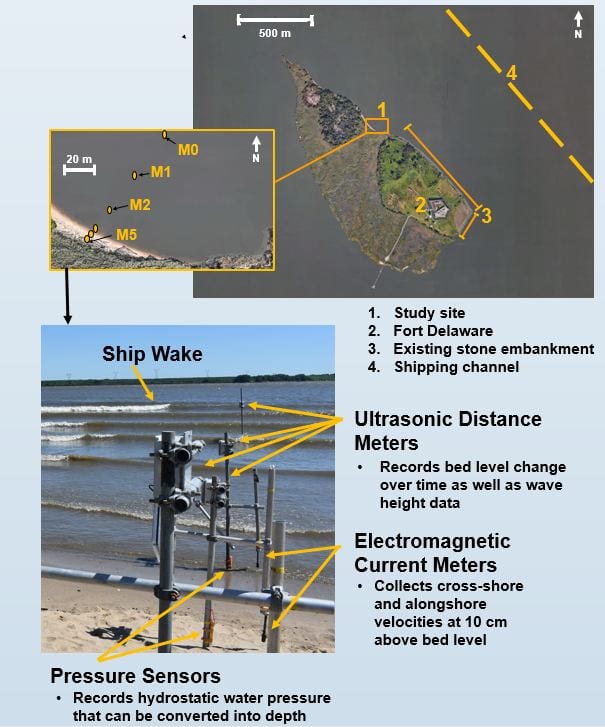
Figure 1. Google Earth view of Pea Patch Island showing transect locations and sensors used for deployment.
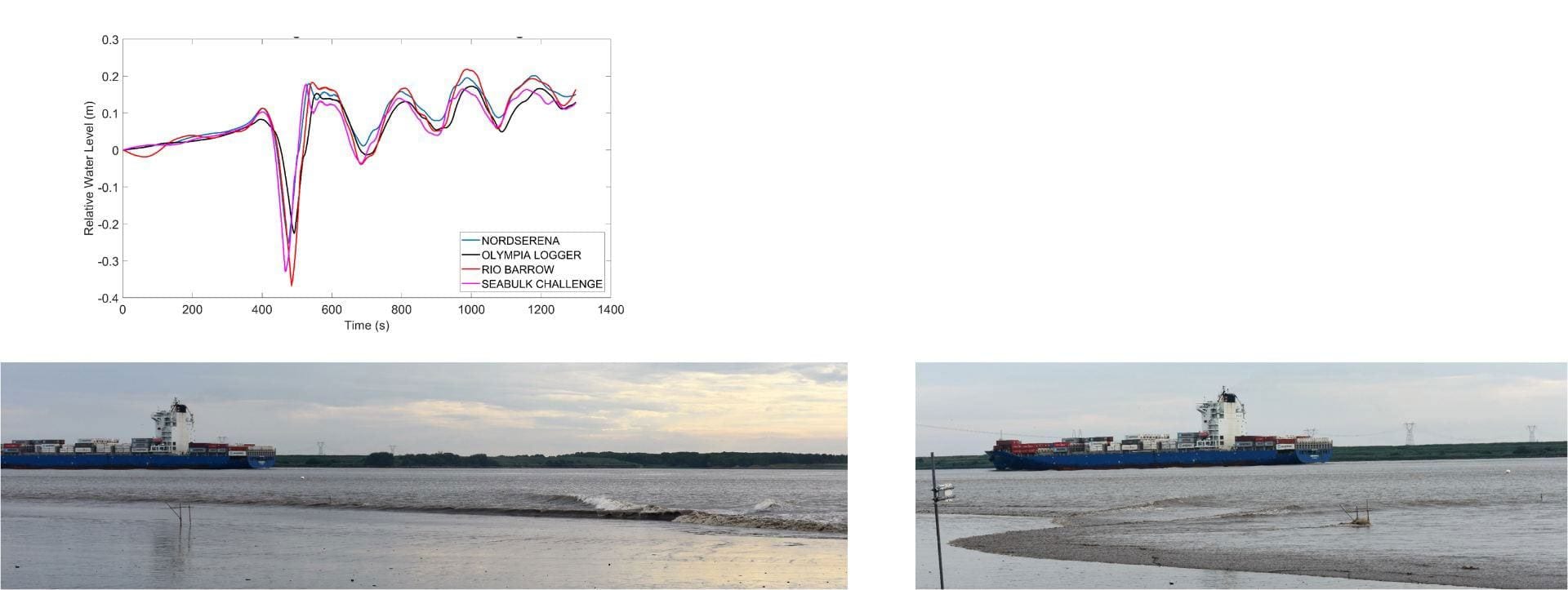
Figure 2. Data (multiple ships) and images showing a container ship heading north. The general shape of the free surface profile is similar regardless of ship with total water level changes on the order of 0.6m. The drawdown (lower left) is large as the ship approaches the island. The subsequent surge (lower right) travels primarily in the alongshore direction but creates runup magnitudes well exceeding those of wind waves.
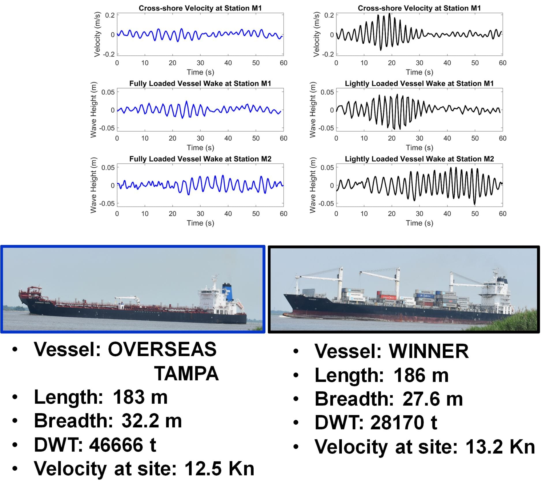
Figure 3. Examples of velocity and water level at several stations for a loaded and unload vessel traveling north past Pea Patch Island.